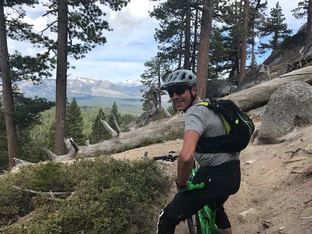
 Jim on Corral and Sierra Sidewinder trail in South Lake Tahoe. The locals who recommended this also sent us to Verde Mexican Rotisserie for the best-ever burritos.
We liked to say we traveled the blue highways on this adventure. Really, it was more about blue trails.
Remember William Least Heat Moon’s classic book Blue Highways about America’s back roads, which were the color blue on old highway maps? Don’t feel bad if you don’t. Today, we’re more likely to see blue routes on our mapping apps. In any case, we drove small highways and gravel roads to towns with names like Carcross and Chicken. We collected highway names such as the Top of the World and the World’s Loneliest highways. At times it seemed our goal was to take the world’s longest time to get anywhere.
However, our true objective was to find mountain biking trails that matched our intermediate, leaning-to-expert, level of riding. On cycling trail maps, blue signifies intermediate, black more advanced. We were eager to experience high elevation climbs, sandy descents and plain old fun. Being terrified was not a goal. Well, so much for that.
Take Thunder Mountain trail, recommended by good friends. About mile 8 of the 15-mile loop, when we found ourselves on a narrow ledge high above red rock cliffs, I wondered if they’d had evil intent. We’re still friends, by the way. This black-level trail in the Red Canyon of Utah had it all: swoops, switchbacks and epic views that rivaled those of nearby Bryce Canyon.
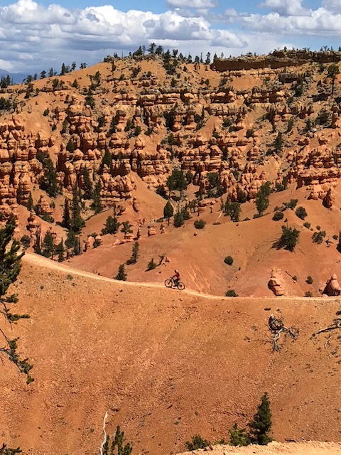
A few exposed sections of the trail stopped me. I tried not to look down but did anyway. Author Malcolm Gladwell once said on a podcast that he overcomes a fearful situation by recalling something from his past that was even more terrifying. Hmmm, a singletrack trail with drop offs on both sides is not nearly as bad as, what? I walked. Fear is healthy, and survival even better.
Jim, skimming a ridge top on Thunder Mountain trail in Utah.
We finished just ahead of a group of mountain bikers from Salt Lake City that we had passed when they regrouped at the top of a steep climb. My spouse does not stop at the top of climbs. In truth, he doesn’t like to stop much. The thirty-somethings complimented us on how strong we were. They had shuttled to make their ride shorter. We hadn’t. Not being boastful, we simply enjoy the extra miles. And, did I mention we’re retired?
There is no rush.
How we find trails:
Apps: We primarily used Trailforks, though others like MTB Project. Unlike us, remember to download the maps for that state before you get to the trailhead where there will not be cell service.
Local bike shops: Folks at bike shops are the best. They’ve got the scoop on new trails, trailhead parking and, often, free camping sites.
Local mountain biking association maps: I’m a cheapskate but have no problem spending money for the trail maps that local groups sell. It supports their work. A few trail groups now offer apps for their local trail systems.
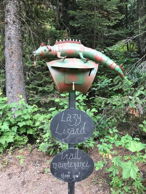
Friends and random mountain bikers: Old and new friends recommended terrific trails: the Yukon River trail in Whitehorse, Yukon, or Lazy Lizard trail in Fernie, BC, to name just two.
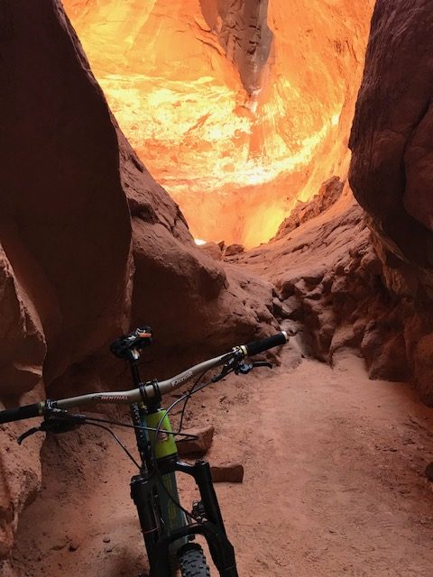
A fun little trail at our campground, Kodachrome Basin State Park in Utah, led to this cave.
(This is the second in a series of stories about our post-retirement van adventure from Ohio to Alaska and back in summer 2018. By the numbers: 13,016 miles. 118 days. 19 states. 3 Canadian provinces. 2 ferries. 0 motels.)